
By Jeff Engen, Broker, Jeff Engen Real Estate, MJB Real Estate Group
Updated October 23, 2026
So you’re thinking about moving to Bellingham, and you’re wondering about one of the biggest parts of life in a new place: the weather. I’ll be straight with you up front. Our winters are gray, they’re wet, and they’re dark. That’s the part people ask me about most, especially folks moving up from out of state.
I’m Jeff Engen, a broker in Bellingham, and I’ve lived through every one of those winters. I’ve been licensed since 2021 and I’ve helped 185 families buy and sell here in Whatcom County, so I hear the weather question just about every week.
I grew up in the Marietta area, and I can’t remember a single winter where the rain was the hard part. It was the 4:30 sunsets.
So let’s go ahead and address the elephant in the room, with real numbers.
Bellingham weather at a glance: the honest answer
Here’s the short version. Bellingham winters are mild, gray, and wet, and they’re long on darkness more than cold. From October through March, you can reasonably expect highs in the mid-40s to upper 50s and lows just above freezing. Most of our roughly 35 inches of yearly precipitation falls in that stretch.
Snow in town is light, about 3.4 inches a year near the bay and closer to 10 inches at the airport and toward the border. Truth be told, the wind and the early sunsets surprise newcomers a lot more than the cold does.
In this video, I walk through all four seasons in Bellingham: winter’s rain and occasional snow, spring’s chilly mornings and warm afternoons, our long, dry summer days, and fall, when the rain and short days come back. I share a few tips for living with the weather here, then finish with the biggest storms of recent years, from the February 2019 snow and the 2016 windstorm to the June 2021 heat wave and the November 2021 flood. Heads up: I rounded a few numbers from memory in the video, so for the official figures, go with the NOAA tables below.
How much does it rain in Bellingham? Month-by-month table
This one surprises people. Bellingham gets about 34.7 inches of rain a year at the airport. That’s less than Seattle’s roughly 39. It drizzles here a lot more than it pours.
These are NOAA’s official 1991–2020 normals for Bellingham International Airport. “Wet days” means days with at least a tenth of an inch.
| Month | Avg high (°F) | Avg low (°F) | Precip (in) | Wet days (≥0.10 in) | Snow (in)* |
|---|---|---|---|---|---|
| Oct | 58.9 | 43.2 | 3.85 | 9 | 0.1 |
| Nov | 51.0 | 37.9 | 5.20 | 12 | 0.8 |
| Dec | 45.5 | 34.1 | 4.33 | 11 | 0.3 |
| Jan | 46.3 | 34.0 | 4.49 | 11 | 1.1 |
| Feb | 48.9 | 34.5 | 2.85 | 9 | 0.6 |
| Mar | 52.8 | 37.5 | 3.36 | 10 | 0.5 |
| Apr | 57.7 | 41.6 | 2.77 | 8 | 0.0 |
| May | 63.9 | 47.0 | 2.23 | 6 | 0.0 |
| Jun | 67.8 | 51.8 | 1.61 | 5 | 0.0 |
| Jul | 72.7 | 55.0 | 0.88 | 2 | 0.0 |
| Aug | 73.1 | 54.7 | 1.13 | 3 | 0.0 |
| Sep | 68.1 | 49.6 | 2.01 | 5 | 0.0 |
| Year | 58.9 | 43.4 | 34.71 | 92 | 3.4 |
*Snowfall comes from NOAA’s Bellingham 3 SSW station near the bay. The airport stopped measuring snowfall in the mid-1990s, so NOAA’s 1991–2020 normals don’t include an airport snowfall figure. The older 1981–2010 normals put the airport at about 10.4 inches a year.
November is our wettest month, and July is the driest, with less than an inch all month. In the grand scheme of things, the rainy season isn’t about any one storm. It’s the gray that settles in from late October to March. When we do get a sun break in the middle of winter, it’s a real breath of fresh air.
The Big Dark: daylight and sunset times from November to February
If there’s one thing I’d tell you to plan for, it’s what locals call “the Big Dark.”
Daylight saving time ends Sunday, November 1, 2026. On Halloween, the sun sets in Bellingham at 5:50 PM. The very next day, it sets at 4:49 PM. That one-hour jump is when most newcomers feel winter really start.
| Date | Sunrise | Sunset | Daylight |
|---|---|---|---|
| Oct 31, 2026 | 7:55 AM | 5:50 PM | 9 h 56 m |
| Nov 1, 2026 | 6:56 AM | 4:49 PM | 9 h 52 m |
| Dec 21, 2026 (solstice) | 8:00 AM | 4:16 PM | 8 h 16 m |
| Feb 1, 2027 | 7:39 AM | 5:07 PM | 9 h 28 m |
All times Pacific.
Side note: our earliest sunset is actually about 4:13 PM in mid-December, a week or so before the solstice. By February the evenings start stretching out again, and honestly, it feels like a pretty big deal.
The short days affect some people more than others, and I won’t pretend they don’t. The Bellingham Herald has a good overview of handling the winter blues, and anything beyond the basics is a conversation for your doctor. One thing I always encourage people who are new to the area to do is plan their warm-weather vacation for fall or winter instead of summer. Summer is arguably the best time of year to be here, so take that trip when the skies are gray.
Wind: Pacific storms in fall, Fraser outflow in winter, and power outages
One commenter on r/Bellingham put it well: the cold here comes from the wind more than the rain. We get wind two ways.
In fall, Pacific storms blow in from the south and southwest. Our trees are still full of wet leaves, and some of them end up on power lines.
In winter, we get something Seattle mostly doesn’t: Fraser outflow, which locals sometimes call a northeaster. Cold, dry Arctic air from interior British Columbia pours down the Fraser River Valley and exits right around Bellingham. In February 2025, UW atmospheric scientist Cliff Mass noted gusts of nearly 45 mph at Bellingham as one of these events arrived. It can feel 15 degrees colder than the thermometer says.
Pro tip: Puget Sound Energy (PSE) provides electricity for most of Whatcom County, and its outage map at pse.com/outage is worth bookmarking before your first windstorm. Blaine and Sumas run their own city electric utilities, so check which provider serves any home you’re considering.
Does it snow in Bellingham? Lowland snow vs. the foothills and Mt. Baker
Yes, but not much in town. NOAA’s current normal is about 3.4 inches a year near the bay, and some winters we barely see a flake. The airport on the north side, which catches more Fraser outflow, averaged about 10.4 inches in NOAA’s older 1981–2010 normals. It usually comes in a few separate events, it sticks around for a handful of days, it melts, and we’re back to business as usual.
The real issue is ice. A little snow plus a hard freeze turns our hills into skating rinks, and because it doesn’t happen often, the whole area slows down for a day or two.
Elevation and exposure change things a lot. NOAA normals show about 9.3 inches a year in Blaine and 10.8 inches at Clearbrook near the border, both more exposed to Fraser outflow. During the February 2025 cold snap, the Bellingham Herald reported about 1 inch in parts of Bellingham, 2 to 3 inches in Sudden Valley, and about 6 inches in Blaine.
Then there’s Mt. Baker, which averages hundreds of inches a season and set the U.S. single-season record of 1,140 inches in 1998–99. The nice part is you drive up to that snow rather than shovel it.
Atmospheric rivers and flood season along the Nooksack
Our biggest storms are atmospheric rivers, long plumes of warm, wet Pacific air. When one stalls over the Cascades, heavy rain and snowmelt can push the Nooksack River over its banks.
That happened most recently in December 2025. According to Whatcom County, a series of atmospheric rivers caused the Nooksack and its tributaries to overflow, with major flooding along the river corridor, particularly in Everson, Nooksack, and Sumas. Many homes were substantially damaged, and the County’s Flood Recovery Information page still lists recovery resources.
It wasn’t the first time. In November 2021, the Nooksack topped its levee at Everson and the water ran north to Sumas, and the National Weather Service reported water damage to more than 85% of homes in Sumas. More on that one below.
If you’re looking at homes in mapped floodplains near the Nooksack, my advice is to check the flood zone, ask about the home’s flood history, and get a flood insurance quote before you write an offer.
The biggest storms in recent memory
Don’t get me wrong, in the grand scheme of things our weather is mild. We don’t get Arizona’s routine triple digits or Florida’s hurricane season. But every so often we get an extreme, and you should know what those look like. I cover each of these in the video, and the links below jump right to that spot. The numbers here come from NOAA and local news records.
- February 2019 snow and cold. Starting Super Bowl Sunday, Fraser outflow locked in arctic air for most of the month. Northeast winds gusted to 60 mph at the airport on Feb. 9, with more than 10,000 power outages in Whatcom County. The main snow came Feb. 11 to 13, and schools closed for days. NOAA’s station near the bay measured 7 inches on the ground on February 13, the National Weather Service logged numerous 4 to 8 inch reports across western Whatcom County, and Clearbrook totaled about 9 inches for the month. It was also the coldest February at Bellingham International Airport since records began in 1949. (NWS/NOAA Storm Events; NOAA NCEI daily station data; Bellingham Herald; Bellingham Herald) ▶ Watch at 10:10
- The March 10, 2016 windstorm. Overnight gusts hit 67 mph at the Bellingham airport, and a spotter northeast of town reported 80 mph. Trees came down on power lines, and a fishing boat broke free near Roeder Avenue and was wrecked on the rocks before the Coast Guard pulled the crew off. (NWS/NOAA Storm Events; Bellingham Herald) ▶ Watch at 11:02
- The June 2021 heat dome. From June 26 to 28, the heat built until Bellingham International Airport hit 99°F on June 28, its all-time record, beating the old mark of 96°F from July 2009. Clearbrook, near the border, reached 106°F, and the heat buckled State Route 544 near Everson. Plenty of homes here didn’t have air conditioning back then, and a lot more do now. (NOAA NCEI; NWS/NOAA Storm Events; Bellingham Herald) ▶ Watch at 11:56
- The November 2021 atmospheric river. Over Nov. 13 to 15, a National Weather Service gauge in Bellingham recorded 5.57 inches of rain in under 72 hours. That’s more than our whole normal November. The Nooksack overtopped its levee at Everson on the night of Nov. 14–15 and flooded Everson, Nooksack, and Sumas, where more than 85% of homes took on water. Landslides closed I-5 south of Bellingham for more than a day, and the river flooded again at the end of the month. (NWS/NOAA Storm Events; Bellingham Herald; Bellingham Herald) ▶ Watch at 13:20
Events like these are rare, but they’re a big part of why I look so closely at elevation, trees, and flood zones when I’m helping someone buy a home here. Which brings me to the next part.
What winter means for the house you buy
This is where the weather starts affecting your money. When I show homes between November and March, here’s what I’m looking at.
Which way the house faces, and the trees around it. A south-facing lot with open sky can make a real difference in January. A house under tall firs on the north side of a hill may barely see direct sun until March, and that affects moss, how fast the driveway dries, and frankly your mood.
Moss, gutters, and drainage. Months of damp means moss on roofs and decks and gutters full of fir needles. I look for downspouts that carry water away from the foundation and for standing water in the yard.
Crawlspace moisture. A lot of older homes here sit over crawlspaces, so the inspection should cover the vapor barrier, ventilation, and any signs of water. One thing I always tell buyers is to ask the inspector to spend real time in the crawlspace. That’s where a wet winter shows up first.
Heat source and backup heat. Heat pumps are common, often paired with a gas furnace, fireplace, or wood stove. Natural gas isn’t available everywhere in the county, so confirm what’s at the street, and ask what keeps the house warm when the power goes out.
Driveways and elevation. A steep driveway is charming in July and a different story in an ice storm. Homes at higher elevation, like parts of Sudden Valley near Lake Whatcom, can see more snow than downtown.
Outage readiness. A generator hookup or a wood stove isn’t a must-have here, but after a fall windstorm it’s one of the features I’m always glad to point out.
If you’d like help weighing these trade-offs on specific homes, that’s exactly what I do. Here’s how I work with buyers.
Is it worth it? How locals handle winter
For the right person, absolutely. The joke here is that if you see someone with an umbrella, they’re probably a tourist. Most of us put the hood up and keep living our lives, whether that’s the walk from the car to the office, a run, or Saturday soccer. Winter here is about planning: get outside in the daylight you have, head up to Baker on snow days, and remember that July is the payoff.
Summer is my favorite season, and it makes up for a lot: dry, long days, and highs in the low 70s. The trade-off is wildfire smoke drifting in from British Columbia or eastern Washington in late summer, which varies a lot from year to year.
My honest advice is to visit in November or February before you commit. If a gray week in November works for you, the rest of the year is easy.
Not sure which part of the county fits you? If you take my Bellingham neighborhood quiz, it’ll match your priorities, like commute, home style, and outdoor access, to areas worth touring. It only takes a couple of minutes. → Take my Bellingham neighborhood quiz
FAQ: Bellingham winter weather
Do I need an umbrella in Bellingham?
Most locals don’t bother. Our rain is mostly drizzle, so a good hooded rain jacket gets a lot more use.
How many sunny days does Bellingham get?
NOAA doesn’t publish an official sunshine count for Bellingham. The normals do show about 92 days a year with at least a tenth of an inch of rain, mostly October through March. Summers are mostly clear, and winters are mostly gray with breaks of sun.
Do I need snow tires in Bellingham?
Lowland snow runs about 3.4 inches a year near the bay to roughly 10 inches at the airport and near the border, usually in just a few events. In town, good all-season tires and a little patience usually do it. If you’ll be driving to Mt. Baker or living at higher elevation, consider traction tires and carry chains. In Washington, studded tires are legal only from November 1 through March 31.
What’s the worst weather Bellingham gets?
In recent memory: the February 2019 snow and cold, the March 2016 windstorm with 67 mph gusts at the airport, the June 2021 heat dome that hit 99°F at the airport, and the November 2021 flooding in Everson, Nooksack, and Sumas. They’re rare, and I walk through each one above.
When is wildfire smoke season?
Usually late summer, sometimes into September or October, depending on fires in British Columbia and east of the Cascades. The Northwest Clean Air Agency posts current conditions.
Thinking about a move to Bellingham or anywhere in Whatcom County? Whether you’re moving next month or two years from now, I’d love to help. Call, text, or email anytime, and I’ll be here to help. → Contact me · Explore Bellingham · Explore Whatcom County
By Jeff Engen, Broker, Jeff Engen Real Estate, MJB Real Estate Group
310 E Magnolia Street #201, Bellingham, WA 98225 · 360-393-9783 · [email protected] · Equal Housing Opportunity Information is deemed reliable but not guaranteed. Weather data is from NOAA and other public sources and is subject to change.
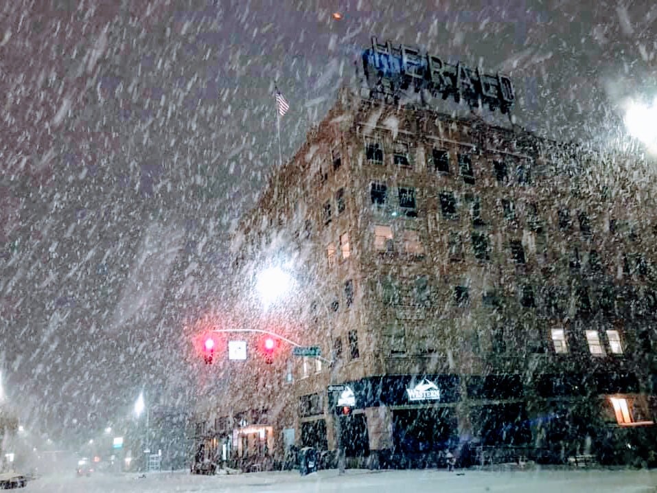
Featured photo: Fernando Gonzalez, CC BY-SA 4.0, via Wikimedia Commons.